1.4.1 Location: Where Is It?

Unit 1 · Introduction to Geography · Lesson 1.4 Five Themes

The big idea Location answers Where is it? You already used the global grid in 1.3.2. This study splits location into two tools: absolute (the exact spot) and relative (compared with another place). Both show up in jobs, and both help you read a real migration.
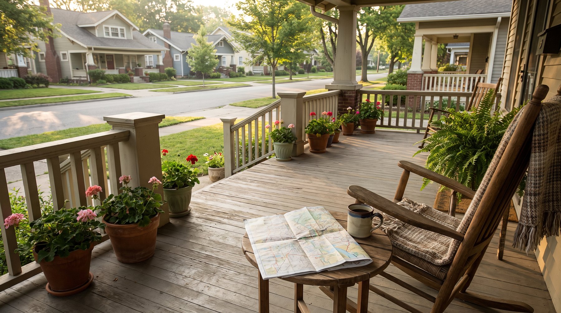
A street you might need directions on

By the end you can

  • Tell absolute location from relative location, and name what pinpoints absolute location.
  • Plot the four study-sheet cities, and name the four indicators used for relative location.
  • Explain how surveyors and meteorologists use location, and what location shows about the 1890 Norwegian migration.
Before you start: you already have the grid

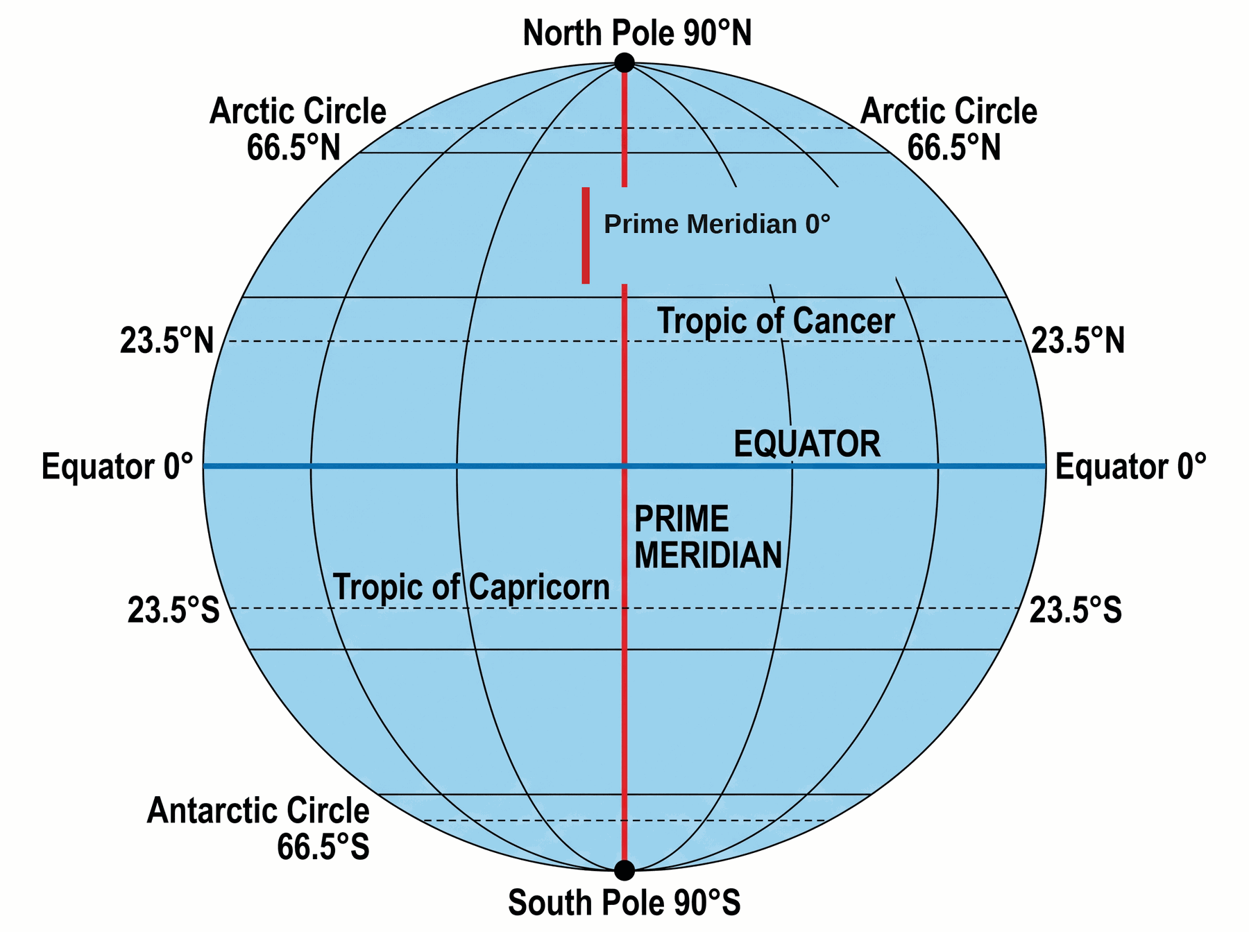
1.3.2 taught latitude and longitude. This study uses that grid as one kind of location, then adds a second kind.

Not sure about the basics underneath this lesson?

Two ways to give directions

Someone stops you and needs to find the Petersons. If you know the house, how you answer depends on what they already know.

Two ways to give directions (2)

You could give the street address: 6525 28th Street. That is absolute location: the exact spot on the planet. It works no matter where the person is starting.

Two ways to give directions (3)

Or you could use landmarks: go to that stop sign, turn left, first right, fifth house on the left, the green one with the rose bushes. That is relative location: one place defined in terms of other known places. Those directions fail if the person is coming from a different starting point.

Two ways to give directions (4)

Location is the theme that answers 'Where is it?' Using both kinds is an essential geographic skill. The lesson's line: we'd be lost without it.

Likely on the quiz Absolute = exact spot, works from anywhere. Relative = compared with a known place, only works if you share that reference.

Absolute location and the grid

Absolute location is useful no matter where you are. Two common ways to pinpoint it: a street address, and the global grid of latitude and longitude. The grid is the broader, more universal method. You already learned it in 1.3.2. This page is a review.

Absolute location and the grid (2)

The global grid is like an x-y axis. The origin, where both coordinates are zero, is the intersection of the equator and the prime meridian. Every position is north or south, and east or west, of that crossing.

Absolute location and the grid (3)

Latitude lines have degrees plus N or S. Longitude lines have degrees plus E or W. 30° N, 90° W is the southern coast of Louisiana. On a closer map of Louisiana, that same pair is New Orleans. Curved meridians on a projection do not change the numbers. 30° N, 90° W is still that place.

Absolute location and the grid (4)

Study sheet Q2: what is used to pinpoint absolute location? A street address, or latitude and longitude (the global grid).

The same grid as 1.3.2. Origin at equator × prime meridian. Latitude first, then longitude.
Likely on the quiz Write latitude first (N or S), then longitude (E or W). The course's check point is still 30° N, 90° W = New Orleans.

Four cities to plot

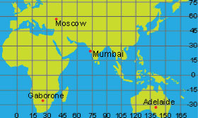
The study sheet asks you to mark four cities. Latitude first, then longitude. Below is Apex's own map for that exercise. Latitude is numbered on the right. Longitude is numbered along the bottom.

Four cities to plot (2)

Adelaide: 35° S, 140° E. Southern Australia.

Four cities to plot (3)

Mumbai: 20° N, 72° E. Western India.

Four cities to plot (4)

Moscow: 55° N, 37° E. Far north, a little east of the prime meridian.

Four cities to plot (5)

Gaborone: 25° S, 25° E. Southern Africa.

Four cities to plot (6)

Apex starts the plot with Adelaide. Find the latitude line, find the longitude line, the city sits at the crossing. Copy those four dots onto your notebook map.

Apex's map for study-sheet Q3. Same four cities, same coordinates.
Likely on the quiz If two cities blur, sort by hemisphere first. Adelaide and Gaborone are south. Mumbai and Moscow are north. Then look at how far east.
Not sure about this bit?

Four ways to say relative location

Absolute location is powerful, but unless you have a good world map or a GPS device, it is not the easiest thing to use. People more often give relative location.

Four ways to say relative location (2)

Descriptions of relative location use four indicators: landmarks, time, direction, and distance. That is study-sheet question 4. Name the four, then use each one on your hometown.

Four ways to say relative location (3)

Worked pattern (swap in your own town):
• Landmark: across from the high school / past the water tower
• Time: about 20 minutes south of the next town
• Direction: north of the river, west of the highway
• Distance: five miles from the courthouse

Four ways to say relative location (4)

The Apex blackboard on this page had more examples. Those exact lines were not captured. The four indicators above are the captured list. Use those four, not a fifth you invent.

Likely on the quiz Q4 wants the four words: landmarks, time, direction, distance. Then one hometown sentence for each.
Not sure about this bit?

Relative location names places too

Relative location is not only for street directions. It is also how we name and describe places inside a larger area. Compass directions are the usual tool.

Relative location names places too (2)

Western Europe: the countries on the western side of the continent. You have to know where Europe is first, so the name is relative.

Relative location names places too (3)

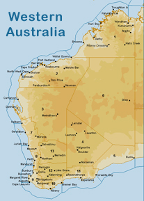
Western Australia: Apex's picture for this page. It is separated from Eastern Australia by a sprawling desert interior. The cultures are very different, and both places are rarely discussed without those relative names.

Relative location names places too (4)

Other relative names from the page: Upstate New York (the northern part of the state), Central Asia (the middle of the continent), Midtown Manhattan (the center of that city).

Relative location names places too (5)

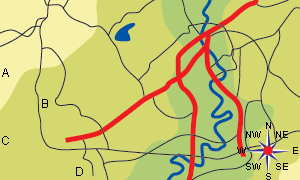
Page 5 is Apex's practice map: points A, B, C, D, red roads, a river, a lake, and a compass rose. The click-questions on that map were not captured. The skill is the same four indicators: landmarks, time, direction, distance. Example with this map: D is south of B. The river is east of the red roads. The lake is northeast of B.

Apex's picture: Western Australia. A relative name. You have to know Australia first.
Apex page 5 map. A, B, C, D plus roads, river, lake, compass. Use relative location to move around it.
Likely on the quiz If a name has west, upstate, central, or midtown in it, you are looking at relative location used as a label.

Location on the job

People in all walks of life use spatial thinking at work. Where spatial thinking is involved, both absolute and relative location are tools of the trade. Apex walks two jobs.

Location on the job (2)

Surveyor. The job is establishing official land and water locations. That work ends up on maps, deeds, leases, government reports, and other legal documents. The surveyor spends the day establishing absolute locations, but needs relative location to get there. In the field: pick reference points that already have known absolute locations. Then measure distances, directions, and angles between those known points and the unknown ones (boundaries, utility poles, hilltops, streams). The relative measurements turn into exact locations for everything in the survey.

Location on the job (3)

Meteorologist. Sample forecast from the lesson: sunny in the morning, rain moving in from the west around noon, a high-pressure system from the north this evening to clear the rain, and the clear skies the satellite shows in the northwest moving in for the rest of the week. Without directions and times, the forecast collapses to 'rain tomorrow around noon, then clear.' All the useful detail depends on relative location. That is study-sheet question 6.
Likely on the quiz Q5 surveyor: known absolute points + relative measurements (distance, direction, angle) = new absolute locations. Q6 meteorologist: direction and time are what make a forecast usable.

The Norwegian migration, through location

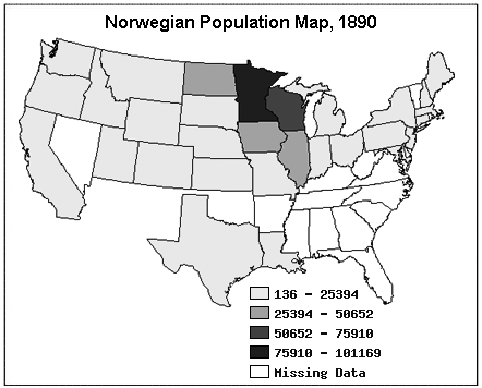
Every study in this lesson applies a geographic skill to the same event. Thousands of Norwegian men and women, mostly farmers, immigrated to North America at the end of the 19th century. Apex's map is titled Norwegian Population Map, 1890. It shows Norwegian-born people by state. Question 7: how can location help you make sense of this migration?

The Norwegian migration, through location (2)

Read Apex's legend. The darkest class is 75,910–101,169. That is Minnesota. The next-darkest band is Wisconsin. Iowa and Illinois sit in the middle band. A lot of the South is white: missing data. They did not sprinkle evenly across the country. They clustered in neighboring north-central states, especially Minnesota.

The Norwegian migration, through location (3)

Absolute location names those states. Relative location notices they sit next to each other.

The Norwegian migration, through location (4)

Later studies in Five Themes reuse this same Norwegian story. For this page, stay on location: clustered, named, next to each other.

Apex's 1890 map. Minnesota is the darkest. The cluster is the Upper Midwest. White is missing data.
Likely on the quiz Q7 is not 'they moved.' It is what location shows: clustering in a few neighboring states, not an even spread.

Your geographer's notebook

Seven questions. Here are the notes to write.

Your geographer's notebook (2)

1. Absolute vs relative. Absolute location is the exact spot on the planet (address or lat/long). It works from anywhere. Relative location defines one place in terms of another (landmarks, time, direction, distance). It only works if you know the reference.

Your geographer's notebook (3)

2. What pinpoints absolute location? A street address, or the global grid of latitude and longitude.

Your geographer's notebook (4)

3. Four cities. Adelaide 35° S, 140° E. Mumbai 20° N, 72° E. Moscow 55° N, 37° E. Gaborone 25° S, 25° E. Mark them on the map in this walkthrough.

Your geographer's notebook (5)

4. Four relative indicators. Landmarks, time, direction, and distance. Then one sentence each for your hometown.

Your geographer's notebook (6)

5. Surveyors. They establish official land and water locations for deeds and maps. They start from reference points with known absolute locations, then use relative measurements (distance, direction, angle) to give exact locations to boundaries and other features.

Your geographer's notebook (7)

6. Meteorologists. Relative location (direction and time) is how they tell people where weather is coming from and when it will arrive. Without that, a forecast has no useful detail.

Your geographer's notebook (8)

7. Norwegian migration, 1890. Apex's map: Minnesota is the darkest class. They clustered in neighboring north-central states, not an even spread. Absolute location names the states. Relative location notices they sit next to each other.
Likely on the quiz Q3 is a plot. Q4 needs the four words plus your town. Q7 is clustering.
Not sure about this bit?

Final checklist

Tick these off as you go. Saved in this browser.