1.3.6 GIS: Geographic Information Systems

Unit 1 Β· Introduction to Geography Β· Lesson 1.3 The Map Case

The big idea An ambulance that arrives in minutes is a geography problem, not only a medical one. GIS is computer geography: if a fact has a where, you can stack it on a map and see a pattern. This walkthrough follows the Apex pages, including the device-sort and the four study-sheet notes.
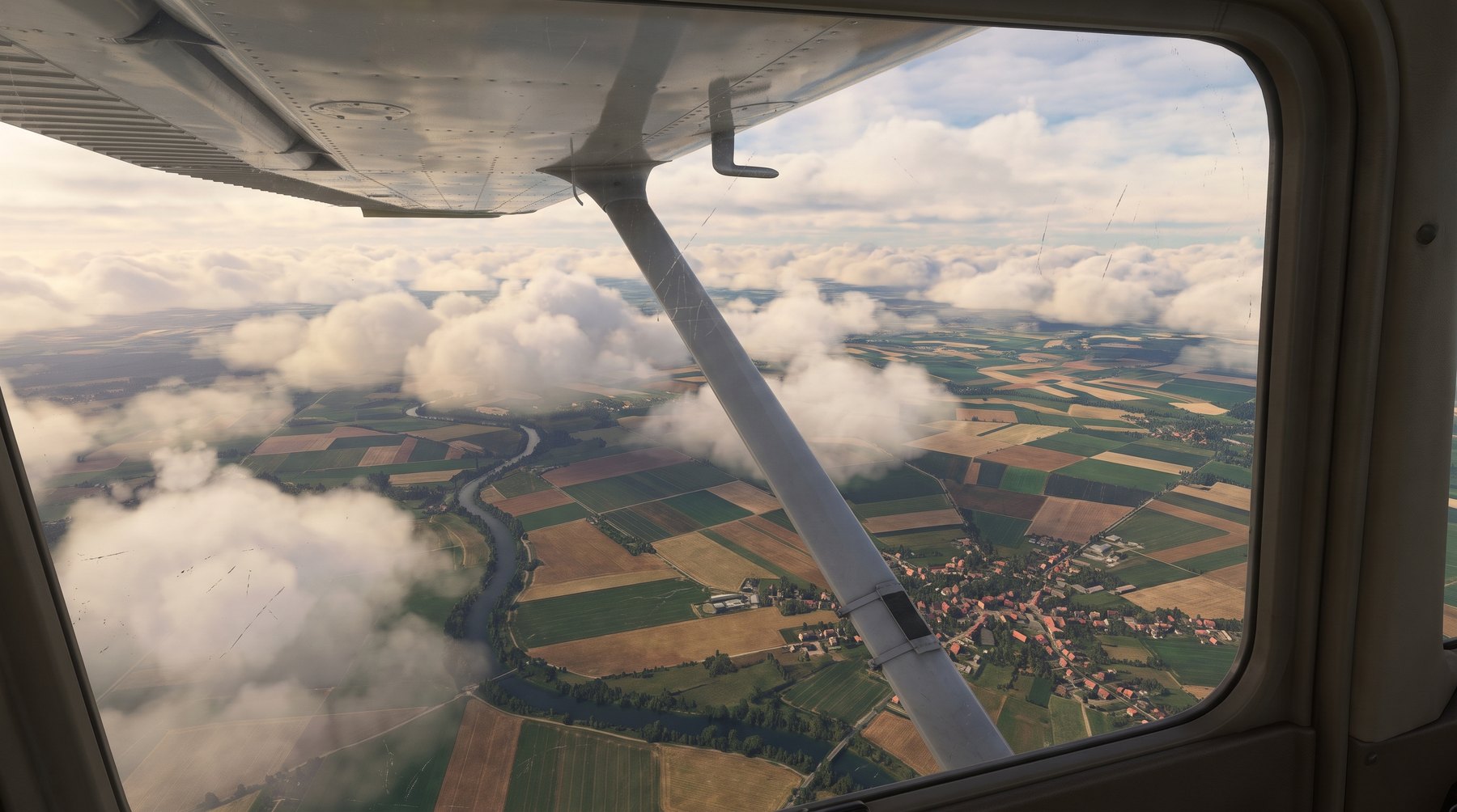
A landscape seen from above

By the end you can

  • Finish the GIS definition: high-tech branch; collect, organize, analyze, and display spatially organized information.
  • Say what Landsat is, and name at least four ways GIS gets its data.
  • Give two real GIS examples from the lesson (emergency response, and one everyday use).
Before you start: GIS is not GPS

The letters look alike. Open this if those two still feel like the same word.

Not sure about the basics underneath this lesson?

Minutes, not just miles

The lesson opens with a baseball game on the first warm day. A ball hits a friend above the ear. She falls. You call 911. In one version, paramedics arrive in minutes. In the other, 56 minutes pass. She is still on the pavement.

Minutes, not just miles (2)

Every second matters when someone is bleeding or having a heart attack. Help has to find the place, and the system has to be set up so help can actually get there in time.

Minutes, not just miles (3)

Geographers who work in geographic information systems use specialized computer software. It makes pictures that help fire and police departments plan who covers which streets. The lesson says that is only part of what GIS can do.

Apex's page-1 picture. Getting help from the station to the person is a geography problem.
Likely on the quiz GIS is not 'a faster siren.' It is a way of seeing whether the plan on the map matches the real calls.

Inside the ambulance, and outside it

On the way to a call, a crew can use GPS to find the accident, and a computer map to choose streets. GIS is also useful back at the office, for the people who design the whole system.

Inside the ambulance, and outside it (2)

St. Johns County Fire Rescue Dispatch in Florida asked a planning question: are our EMS zones actually working?

Inside the ambulance, and outside it (3)

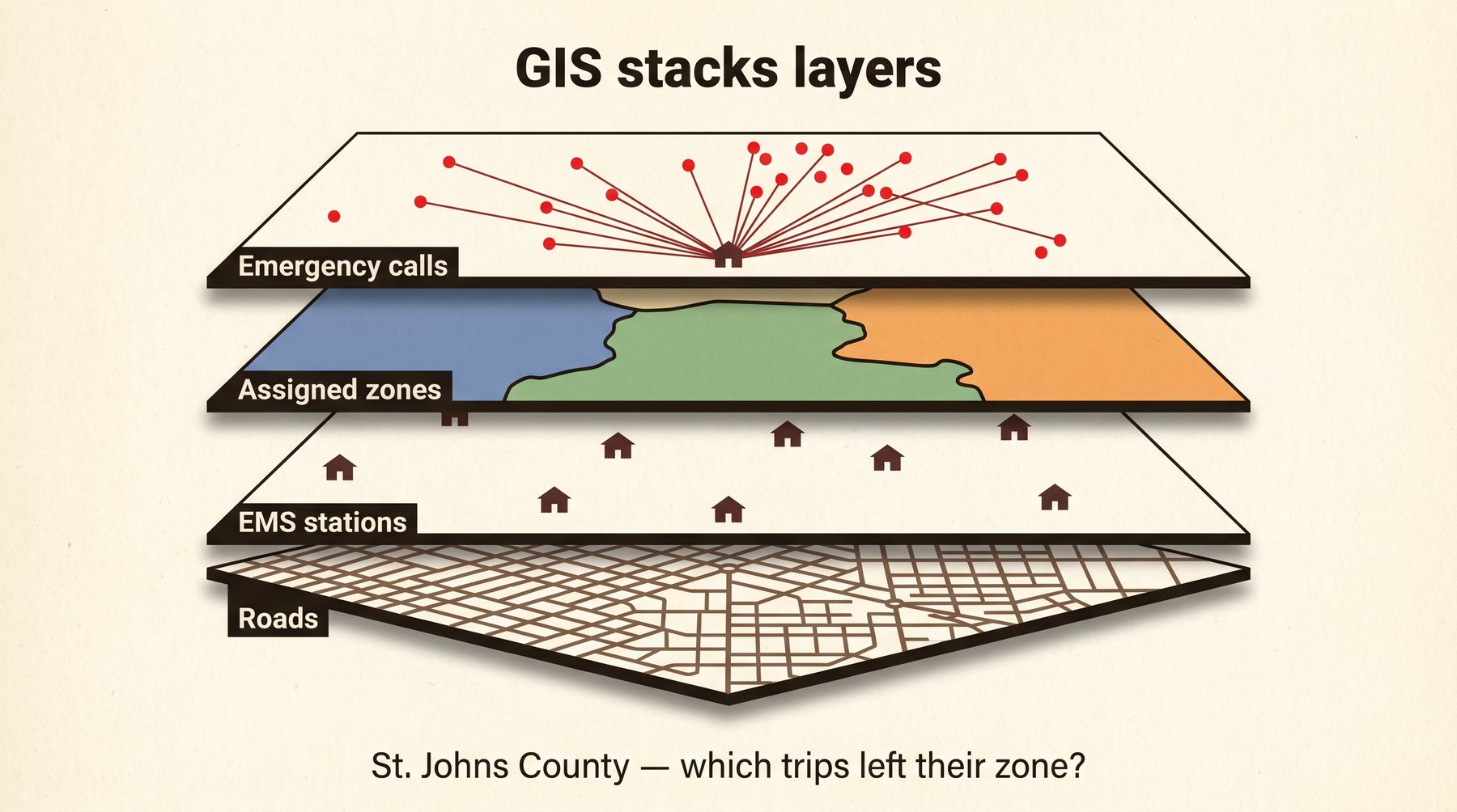
Analysts did not guess. They stacked layers:
1. A road map of the county
2. Where each EMS unit sits (from addresses)
3. Each unit's assigned region, colored in
4. A database of more than 12,000 real calls: address, type, which unit went, how long the drive took

Inside the ambulance, and outside it (4)

Each line on the spider diagram is one trip from a station to a house. Put that on top of the colored zones and you can see which trips stayed inside their zone and which did not. Officials could then decide: redraw the zones, or add units.

Inside the ambulance, and outside it (5)

The human eye is good at patterns. A picture of 12,000 trips is easier to decide from than a spreadsheet of 12,000 rows.

How that Florida map was built: roads, then stations, then zones, then the actual calls as spider lines.
Likely on the quiz If a question describes stacking roads, stations, and calls to check ambulance coverage, that is this slideshow.
Not sure about this bit?

A fact has to have a where

GIS is a high-tech branch of geography, and it is relatively new. Experts use computers to organize, display, and analyze information that is spatially organized β€” tied to a place. If it has a location, GIS can work with it.

A fact has to have a where (2)

That sentence is also your study-sheet definition. GIS is a fast-paced, high-tech branch of geography that uses computers to collect, organize, analyze, and display all forms of spatially organized information.

A fact has to have a where (3)

Where the facts come from, as this page lists them:
β€’ Traffic cameras over highways
β€’ Landsat: Earth-orbiting satellites that do remote sensing (NASA's program)
β€’ Bar-code scanners in stores
β€’ Scanners that score standardized tests
β€’ Instruments that measure water temperature, air quality, and similar things

A fact has to have a where (4)

Those feeds go into databases that can update all the time. GIS software taps them and makes a picture people can read.

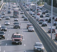
Apex's page-3 picture. Traffic cameras over highways are one GIS data source.
Likely on the quiz Landsat is the named satellite program. Write the key-term line: Earth-orbiting satellites that perform remote sensing missions.

Which devices count

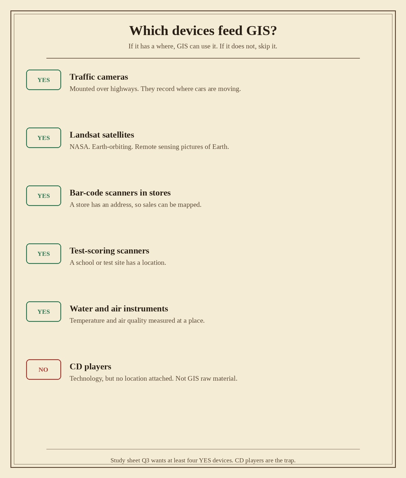
Page 4 is a sort. GIS software only works if it is given real-world data. Not every gadget counts. The test is the same every time: does this device collect information that can be tied to a place?

Which devices count (2)

Traffic cameras. Yes. They sit over highways and record where traffic is moving. That can become a traffic-flow map for commuters.

Which devices count (3)

Landsat satellites. Yes. NASA. They orbit Earth and take remote-sensing pictures. That is study-sheet question 2.

Which devices count (4)

Bar-code scanners in stores. Yes. A store has an address, so what sold there can be put on a map.

Which devices count (5)

Scanners that score standardized tests. Yes. A school or test site has a location.

Which devices count (6)

Instruments that measure water temperature and air quality. Yes. Those readings happen at a place.

Which devices count (7)

CD players. No. A CD player is technology. It does not attach a location to a fact. That is the trap on this Apex page. Leave it off question 3.
The sort from page 4. Four or more YES devices go on the study sheet. CD players do not.
Likely on the quiz If a quiz names a gadget with no where, it is the CD-player kind of trap.
Not sure about this bit?

Pictures help people decide

GIS analysis helps people make better decisions and provide more effective services. The lesson names a wide range: agriculture, banking, government services, scientific studies.

Pictures help people decide (2)

Organizations use GIS maps to ask two planning questions. Should we change the current system? What might happen if we do?

Pictures help people decide (3)

Why bother with a picture at all? The human eye and brain are very good at recognizing patterns. A stacked map of 12,000 ambulance trips is easier to decide from than a table of 12,000 rows. That is the same reason St. Johns County drew the spider diagram.

Likely on the quiz If a question asks why GIS makes a picture instead of leaving the data in a table, the answer is patterns. Eyes catch them.

From A-to-B maps to pattern maps

GIS changed what cartographers can put on a map. Older maps focused on getting from point A to point B. GIS maps can show much broader information: demographics, crime rates, school needs, fire coverage.

From A-to-B maps to pattern maps (2)

That is the impact on mapmaking. Same Earth. Wider job. Fire departments and schools are the lesson's examples of organizations that need those pictures.

From A-to-B maps to pattern maps (3)

This does not replace the person. 1.3.3 already said humans still make maps. GIS is a tool in that studio.

Likely on the quiz Old job of a map: navigate. New job GIS adds: see a pattern (crime, prices, calls) so someone can decide.

You already use this

High-tech geographic information is already part of daily life. The lesson names two you can touch, then asks you to notice a third.

You already use this (2)

GPS in a rental car: detailed directions to a destination. Phones do the same job now. GPS finds where you are. A map on top of that is GIS using GPS as one input. Keep the letters separate.

You already use this (3)

Dallas traffic: the Texas Department of Transportation site shows which highways are jammed right now. Drivers use it to plan the route and the time. Traffic cameras from page 3 are the kind of feed behind a map like that.

You already use this (4)

Zillow: Landsat plus linked databases. Type an address. See the house from space, and see how its price compares with the neighborhood.

You already use this (5)

Those last two, plus the St. Johns County EMS map, are study-sheet question 4. Pick two.

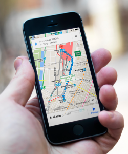
Apex's page-7 picture. Nearly everyone has GPS maps on a phone. GPS finds you. GIS is the bigger stacking system.
Likely on the quiz GPS is a locator. GIS is the stacking-and-deciding system. Zillow's satellite piece is Landsat.

Your geographer's notebook

Four questions. Here are the notes to write, from the pages you just walked.

Your geographer's notebook (2)

1. Finish the sentence. GIS is a fast-paced, high-tech branch of geography that uses computers to collect, organize, analyze, and display all forms of spatially organized information.

Your geographer's notebook (3)

2. What makes up the Landsat program? Earth-orbiting satellites that perform remote sensing missions. NASA's program.

Your geographer's notebook (4)

3. List at least four technologies that gather data GIS uses. Traffic cameras. Landsat satellites. Bar-code scanners in stores. Scanners that score standardized tests. Instruments that measure water temperature and air quality. Write four of those. Do not write CD players.

Your geographer's notebook (5)

4. Give two examples of GIS technology in action. Pick two: St. Johns County stacking 12,000 emergency calls to check ambulance zones. Dallas live traffic so drivers can avoid jams. Zillow showing a house from space and comparing its price to the neighborhood. GPS maps in rental cars or on phones.
Likely on the quiz Q1 is the definition. Q2 is Landsat. Q3 is four YES devices. Q4 is two stories from the lesson.
Not sure about this bit?

Final checklist

Tick these off as you go. Saved in this browser.